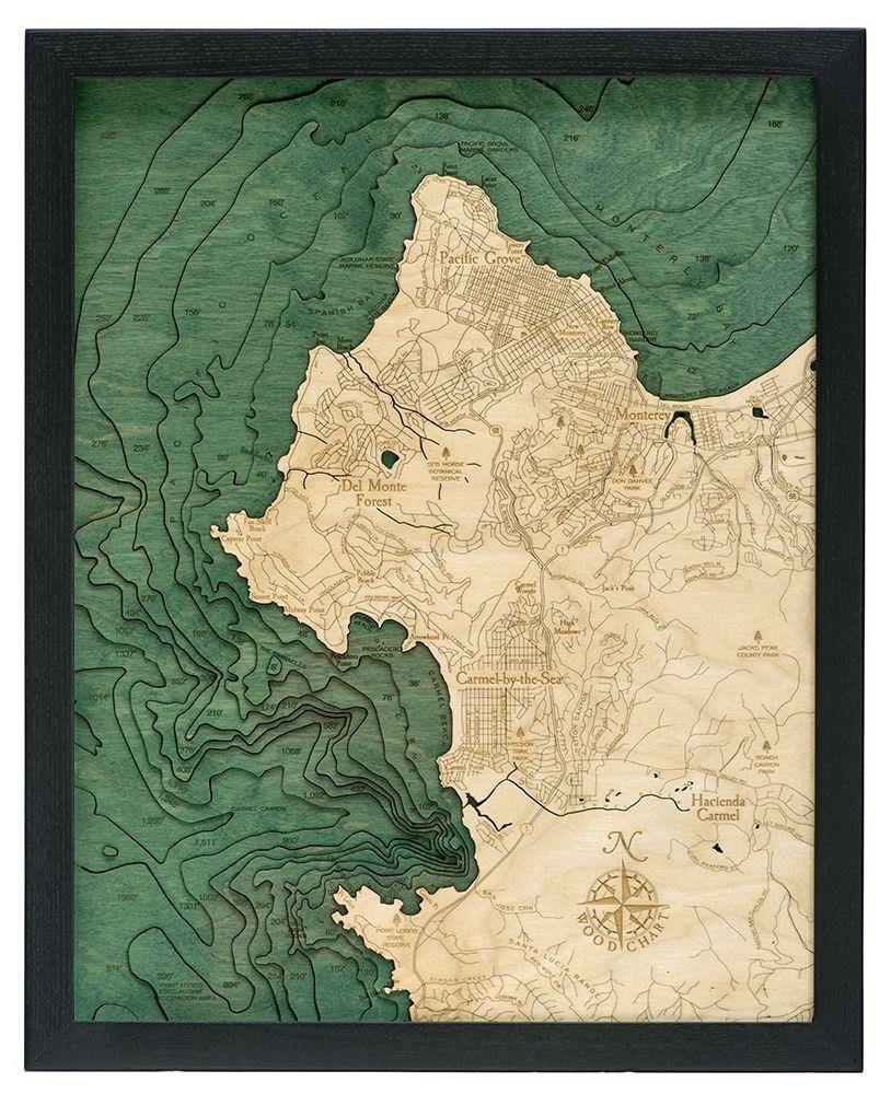

San Francisco Wood Chart
A shallow, productive estuary, San Francisco Bay connects the Sacramento and San Joaquin rivers with the Pacific Ocean. Gathering the rainfall and ...
View full detailsA shallow, productive estuary, San Francisco Bay connects the Sacramento and San Joaquin rivers with the Pacific Ocean. Gathering the rainfall and ...
View full detailsLocated high in the Sierra Nevadas, Lake Tahoe is the largest alpine lake in North America and, with a maximum depth of 1,645 feet, it’s also Ameri...
View full detailsGolden Gate, San Francisco. A 3-D nautical wood map featuring the Golden Gate of San Francisco California. A close up of the one-mile wide strait ...
View full detailsReferred to locally simply as “The Cape”, it’s historically a summer getaway for maritime-minded tourists seeking sunny beaches and old-world charm...
View full detailsManhattan is the most densely populated borough of New York City, and is often described as the cultural and financial capital of the world. The bo...
View full detailsA wood map featuring the Island of Ireland. The current population of Ireland is about 6.4 million. The island has a rich culture and history, with...
View full detailsMore than 150 rivers and streams drain into Chesapeake Bay, the largest estuary in the United States. It drains a basin of over 64,000 square miles...
View full detailsThe only one of the Great Lakes located entirely in the US, Lake Michigan's beaches are sometimes referred to as the Third Coast (after those of th...
View full detailsThe 124 mile stretch of California coastline between Los Angeles and San Diego. This piece comes ready to hang, pre-framed in a custom, solid-wood ...
View full detailsMonterey Bay is a bay of the Pacific Ocean located on the coast of California. Santa Cruz is located at the north end of the bay and the city of Mo...
View full detailsA rocky island that measures 22 miles from tip to tip, Catalina (as it’s referred to locally) is home to almost 4,000 people. Nearly all live in th...
View full detailsCarmel and Monterey. A 3-D nautical wood map featuring the Carmel-by-the-Sea - Monterey area. This California oasis features an eclectic mix of gor...
View full detailsLong Island Sound, featuring the entire Long Island Sound, from southern Connecticut to Queens, NY. Centered around Long Island, New York, this cha...
View full detailsConnected to the Atlantic Ocean through the Saint Lawrence Seaway and the Great Lakes Waterway, this collection of freshwater lakes represents the ...
View full detailsA wood map featuring the Mediterranean region of Northern Africa, Southern Europe, and the Middle East. Points of interest include: Albania, Algeri...
View full detailsNarragansett Bay, Rhode Island. A 3-D nautical wood map featuring Narragansett Bay and Newport, Rhode Island. Narragansett Bay, on the north side ...
View full detailsChicago and the southwestern shore of Lake Michigan. Points of Interest Include:br Chicago Harbor, Chicago River, Lincoln Park Zoo, Goose Island, ...
View full detailsAn intricate network of coastal waterways, the Salish (SAY-lish) Sea includes the Strait of Georgia, the Strait of Juan de Fuca, the Puget Sound, a...
View full detailsLake Winnipesaukee features more than 250 islands and an impressive 288 miles of shoreline, making it the most elaborate of all the wood charts. It...
View full detailsNantucket is primarily an affluent summer colony. Most of its homes are seasonally occupied, and in the summer months the island’s population swell...
View full detailsCentered around the Hamptons, this chart details the beauty of the Atlantic estuary known as Long Island Sound. Its tidal marshes are some of the m...
View full detailsThe shallowest of the Great Lakes, Lake Erie is downstream of Lake Huron. Water flows through Lake St. Clair, and into Lake Erie via the Detroit Ri...
View full detailsBaja is the second longest peninsula in the world and is a popular destination for vacationers, sport-fishermen, whale-watchers, and desert-racers ...
View full detailsMichigan Route M22, Michigan. The M22 Highway showcases the scenic shorelines Michigan has to offer. Along the route are breathtaking views, restau...
View full detailsKennebunkport, Maine. Beautiful Kennebunkport features Dock Square, Goat Island Lighthouse and the Seashore Trolley Museum. Kennebunkport became a ...
View full detailsThe California Coast. A 3-D nautical wood map featuring over 1,264 miles of California's beautiful coastline. If you include all the small bays an...
View full detailsDoor County, Wisconsin, featuring the western arm of Lake Michigan, Green Bay, in Door County, Wisconsin. To avoid confusion with the city, which ...
View full detailsNew York City, featuring all 5 boroughs of New York. The New York metropolitan area, from Queens in the east, to Newark, NJ in the west, is home to...
View full detailsThe entire state of Alaska, featuring Alaska, the Bering Sea, Arctic Ocean and Gulf of Alaska. Alaska was purchased from Russia by the United State...
View full detailsWestern Europe, featuring all of Western Europe - from the UK to Turkey, from Latvia to Spain. Points of Interest Include: Austria, Belarus, Belgiu...
View full detailsA wood map featuring Whidbey and Camano Islands in Washington State. Whidbey Island is the largest island in the state of Washington, followed by ...
View full detailsA wood map featuring Portland, OR, Vancouver, WA, and the Columbia and Willamette Rivers. Portland is Oregon's largest city, with a population of a...
View full detailsA wood map featuring the shoreline of Southern New Jersey. Famous for its many boardwalks with arcades, water parks, and amusement parks boasting h...
View full detailsA wood map featuring the Florida cities of Cape Coral and Fort Myers. Cape Coral has more canals than any other city in the world. It is the larges...
View full detailsA wood map featuring Charlotte Harbor and Venice, Florida. Charlotte Harbor is the second largest bay in Florida. It is located on the Gulf of Mexi...
View full detailsA wood map featuring the San Diego area in Southern California. San Diego is the second largest city in California and the eighth largest in the Un...
View full detailsReferred to locally simply as "The Cape", it's historically a summer getaway for maritime-minded tourists seeking sunny beaches and old-world charm...
View full detailsLocated in northwestern Iowa, Spirit Lake and the two Okoboji lakes are collectively known as "The Iowa Great Lakes". They are the largest natural ...
View full detailsLake Winnebago is the largest lake entirely within the state of Wisconsin. It has many shallow reefs along the west shore, and a drop-off type of s...
View full detailsOregon's 363 miles of coastline. This piece comes ready to hang, pre-framed in a custom, solid-wood frame. Its rich contours are carefully crafted...
View full detailsThe Cayman Islands are a British Territory in the western Caribbean Sea. Grand Cayman is the largest of the three Cayman Islands and is home to the...
View full detailsNewport Beach. A 3-D nautical wood map featuring Newport Beach and Costa Mesa, in Orange County, California. The Upper Bay of Newport is a canyon, ...
View full detailsServing as shelter for oceangoing vessels from the notoriously-rough Alaskan seas, the US portion of the Inside Passage encompasses approximately 1...
View full detailsLake Washington, in King County, Washington is a large, freshwater, ribbon lake that's adjacent to the city of Seattle. It is fed by the Sammamish ...
View full details